




Table of Contents Show
Restoring a damaged piece of land has always required a particular kind of knowledge. You need to know what grew there before, what is growing there now, what the soil can support, and which plants will help rather than harm. For decades, that knowledge sat with ecologists, extension officers, and consultants whose time was expensive and hard to book. A farmer with a tired pasture or a landowner with a weedy creek bank often had to guess. EcoPlot, a land intelligence app developed by MillPont, is trying to change that by putting AI-assisted ecological guidance into the hands of the people who actually manage the land. This article looks at how it works and where it fits.
The Knowledge Gap That Slows Restoration Down
Most restoration projects do not fail because people lack motivation. They stall because the first steps are confusing. Should you remove the invasive shrubs first or plant natives around them? Is the bare patch on the hillside a soil problem, a drainage problem, or a grazing problem? Which species are native to your area at all?
Answering these questions usually means pulling together several sources: a soil lab report, a regional plant guide, satellite photos, notes from past seasons, and advice from a neighbor who tried something similar. Each source is useful alone, but the real value comes from connecting them, and that is where many people get stuck. Small landholders and new producers feel this most. They rarely have a consultant on call, and generic advice found online does not account for the specific conditions of their land.
What AI Brings to Ecological Planning
Artificial intelligence is good at a task that people find tiring: looking at many pieces of information at once and spotting patterns. In land restoration, that means combining where a parcel sits, what the satellite imagery shows, what species have been observed there, and what the soil data says, then turning all of it into practical suggestions.
An AI planning tool for farmers and land managers does not replace field experience. A rancher who has walked the same hills for twenty years will notice things no algorithm can. What the AI does is shorten the research stage. Instead of spending evenings cross-checking plant lists and soil charts, a landowner gets a starting point tailored to their location, which they can then test, adjust, or reject based on what they see on the ground.
The other benefit is consistency. Recommendations are built from the same data each time, so changes in advice usually reflect changes on the land rather than differences between advisers.
How EcoPlot Builds a Picture of Your Land
Starting From the Satellite View
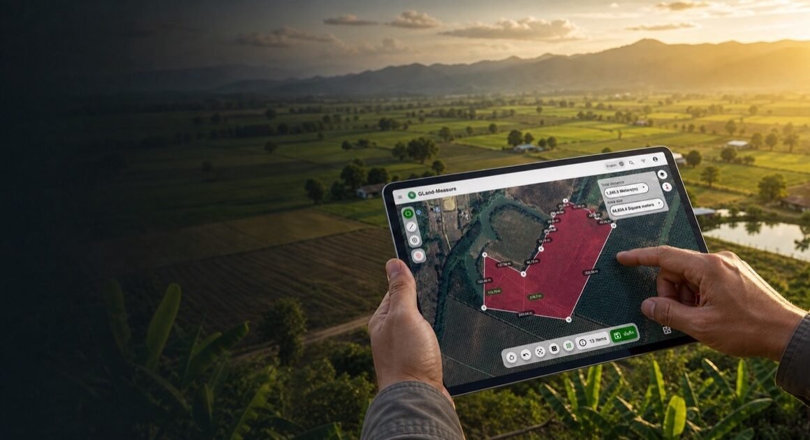
The process begins with a map. Users locate their property on satellite imagery and select the field or parcel boundaries they want to work with. This step matters more than it might seem. Restoration needs differ from one part of a property to another, and drawing clear boundaries lets a creek bank, a hilltop pasture, and a garden bed be treated as separate areas with their own conditions.
Adding What Lives There
Next comes the living layer. EcoPlot lets users record plant and wildlife observations and identify species from photos, and it can identify birds and other wildlife by sound. Each observation adds detail that satellite imagery cannot capture. Knowing that a field margin already hosts certain native wildflowers, or that a particular invasive vine has started climbing the fence line, changes what a sensible restoration plan looks like.
Bringing in the Soil Data
Soil is often the hidden factor behind restoration success. Users can upload laboratory soil test reports to the app, so recommendations can take soil conditions into account rather than treating every patch of ground the same. A plant that thrives in one soil may struggle in another just a few hundred meters away.
From Data to a Restoration Plan
With the map, observations, and soil information in place, the app’s AI-powered recommendations can suggest next steps. These might include native species suited to a particular area, guidance on dealing with invasive plants that have been identified, or ideas for planting and landscape design that support local wildlife.
Invasive species are a good example of where this guidance helps. Many restoration efforts begin with clearing aggressive non-native plants, but removal done poorly can leave bare ground that invites the same invaders back. EcoPlot provides information on native and invasive species and supports invasive species treatment planning, which helps users think about what comes after removal, not just the removal itself.
For producers working toward regenerative goals, this kind of planning fits naturally into wider practices like rotational grazing, cover cropping, and hedgerow planting. Using a regenerative agriculture app alongside those practices makes it easier to see which changes are making a difference and where to focus effort next season.
Keeping a Record of Progress
Restoration is slow. Native grasses may take several seasons to establish, and wildlife often returns gradually. Without records, it is easy to forget what the land looked like at the start and underestimate the progress that has been made.
EcoPlot includes field journals for environmental documentation, so users can keep notes, observations, and photos linked to specific places on their land. Over time, this becomes a history of the property: when an area was cleared, what was planted, which species appeared afterward. That record is useful for personal decisions, and it can also help when applying for stewardship programs or sharing results with buyers who care about how food and fiber are produced.
The app also supports community collaboration, allowing environmental observations to be shared. For people working in isolation, seeing what others in similar landscapes are recording can be both encouraging and informative.
Who Benefits Most From This Approach
The clearest beneficiaries are people who manage land without a dedicated ecological adviser. That includes small and mid-sized farmers, ranchers testing regenerative methods, landowners with neglected acreage, and conservation volunteers caring for local sites.
For these users, a land stewardship app for producers offers a practical way to move from good intentions to a workable plan. It does not make restoration effortless. Physical work, patience, and local judgment are still required. What it does is lower the barrier to getting started and reduce the chance of costly early mistakes, such as planting species that will not suit the soil or clearing invasives without a plan for what replaces them.
Gardeners and nature enthusiasts can benefit too, especially those turning lawns or neglected corners into wildlife-friendly spaces.
Conclusion
Land restoration has long depended on expertise that many landowners could not easily access. By combining satellite mapping, species identification, soil reports, and AI-powered recommendations in one place, EcoPlot works as an AI planning tool for farmers and land managers that helps close that gap. It gives farmers, ranchers, and landowners a clearer view of what their land needs and a starting point for action, while leaving the final decisions with the people who know the ground best. The technology will not plant a single tree on its own, but it can make the path from a degraded field to a healthier, more diverse landscape easier to see and easier to follow.